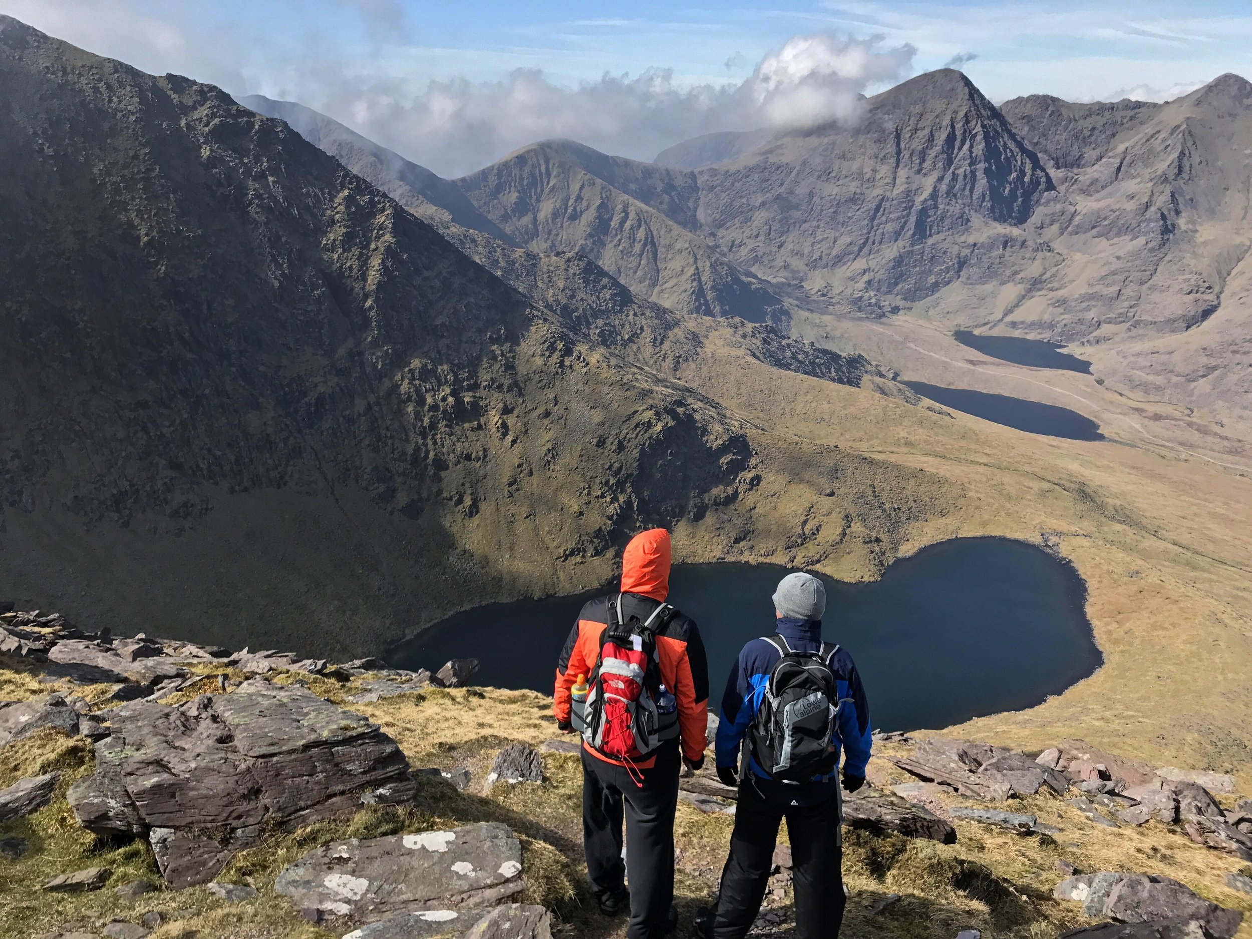
Ireland’s mountains are a tapestry of ancient landscapes, rich mythology, and breathtaking natural beauty. From the dramatic peaks of Kerry’s MacGillycuddy’s Reeks to the quiet majesty of Wicklow’s rolling uplands, they offer something for every walker and adventurer. Shaped by glacial forces and steeped in folklore, these ranges provide a gateway to solitude, challenge, and connection with nature. Whether you’re tracing old pilgrim paths, summiting rugged ridgelines, or wandering peaceful valleys, Ireland’s mountains invite you to explore at your own pace. Here I capture and talk a little about my favourite mountains, hikes and treks.
The Geology of Ireland’s Mountain Ranges
Ireland’s mountain landscapes, though modest in height today, are among the oldest in Europe and once rivalled the world’s greatest ranges. Forged through colossal geological forces, sculpted by glaciers, and softened by millennia of erosion, Ireland’s mountains are ancient sentinels that trace the story of deep time.
Most of Ireland’s uplands owe their origins to two massive mountain-building episodes — the Caledonian Orogeny (c. 470–400 million years ago) and the Variscan Orogeny (c. 360–300 million years ago). These continental collisions once raised peaks that would have dwarfed the present-day Alps and Pyrenees. Over hundreds of millions of years, relentless weathering and erosion have reduced these once-mighty ranges to their current forms — worn, graceful, and shaped by ice, wind, and rain.

The Caledonian Orogeny was responsible for the formation of many of Ireland’s northern and eastern uplands, including the Dublin and Wicklow Mountains, Blue Stack Mountains, Derryveagh Mountains, Ox Mountains, Nephin Begs, and Twelve Bens. These ranges primarily consist of granites, schists, and metamorphosed sediments. In the Wicklow Mountains, for example, slow-cooling magma deep beneath the surface formed the vast granite mass that now underlies rounded summits like Lugnaquilla and Djouce. The Twelve Bens and Maumturks of Connemara, dominated by hard quartzite, bear a more rugged, serrated appearance due to their resistance to erosion.
Further north, the Mourne Mountains and Cooley Mountains represent some of the youngest uplands in Ireland, geologically speaking, formed around 50 million years ago during the Paleogene period. Their distinctive dome-like summits and tors were shaped from large granite intrusions. The Mournes in particular showcase classic glacial and periglacial features, and their pristine granite character has long made them a favourite for hikers and geologists alike.
The Variscan Orogeny, a later tectonic upheaval, shaped Ireland’s southern ranges — including the MacGillycuddy’s Reeks, Caha Mountains, Beara Peninsula hills, Slieve Mish, Galtees, Comeraghs, Knockmealdowns, and Slievenamon. These ranges are largely composed of Old Red Sandstone, laid down during the Devonian period in vast alluvial plains and later uplifted, folded, and faulted into mountainous terrain. The Reeks, home to Carrauntoohil (1,038m), Ireland’s highest peak, present sharp ridges, glacial corries, and deep valleys carved during successive glaciations. Despite their relatively young age in geological terms, their sandstone composition makes them highly susceptible to weathering, resulting in rugged peaks and steep scree-filled slopes.
Some of Ireland’s most ancient ranges, like the Slieve Bloom Mountains, contain rocks that date back over 400 million years, including Silurian shales, slates, and sandstones. These mountains were once part of a towering system possibly as high as the present-day Himalayas, but hundreds of millions of years of erosion and a cooler, wetter climate have reduced them to rounded hills cloaked in thick peat and forest.
Glaciation during the Quaternary period, particularly the last Ice Age (approximately 25,000 to 11,500 years ago), played a defining role in shaping Ireland’s present-day mountains. Massive ice sheets advanced and retreated across the island, carving U-shaped valleys, gouging out corrie lakes, and depositing moraines and erratics across the landscape. The Comeraghs, for instance, boast one of the finest examples of a glacial corrie in Western Europe — Coumshingaun — with its sheer cliffs and still, dark waters. Similarly, the Galtee Mountains reveal spectacular corrie lakes such as Lough Curra and Diheen, nestled below steep sandstone escarpments.
The Slieve Felim and Silvermine Mountains, stretching across Limerick and Tipperary, form part of Ireland’s lesser-known ranges. Though lower and less dramatic, they exhibit a geological blend of ancient marine sediments and later intrusions, with gentle summits and rich biodiversity.
In the west, the Nephin Beg Range, Mweelrea, and Partry Mountains were similarly moulded by glacial action, with resistant quartzite and schist forming high ridges and plateaus. Mweelrea, Connacht’s highest peak, rises sharply above Killary Harbour and exhibits a striking combination of steep slopes, hanging valleys, and deep coums — hallmarks of intense glacial modification.
In the far northwest, the Derryveagh Mountains of Donegal and the nearby Bluestacks combine ancient metamorphic rocks and extensive peat coverage. These ranges are among the most remote and least disturbed in Ireland, characterised by a wild, boggy beauty and striking glacial landforms.
To the east, the Cooley Mountains, though compact, pack geological and mythological significance. Their granite cores and glacially carved flanks overlook Carlingford Lough and were the mythic setting of the Táin Bó Cúailnge, where Cú Chulainn defended Ulster. Their structure, similar to the Mournes, reflects deep granite intrusions sculpted by erosion and ice.
Today, erosion and weathering continue to shape Ireland’s mountains. Chemical weathering (especially in granite regions like Wicklow and Mourne) slowly breaks down minerals, forming boulder fields and tors. Freeze-thaw action in higher sandstone and quartzite areas fractures exposed rock, creating scree slopes and rockfall features. In many areas, peat has built up over thousands of years due to high rainfall and low evaporation, blanketing large portions of uplands such as the Ox Mountains, Slieve Blooms, and Wicklow Uplands. This peat, while ecologically important, also conceals much of the underlying geology.
Rivers originating in Ireland’s mountains — the Barrow, Suir, Shannon, Liffey, and Moy among them — continue the slow process of erosion, carving valleys and transporting sediment to the lowlands. Radial drainage patterns are evident in ranges like the Slieve Blooms, where streams radiate outward from a central upland dome.
Despite their weathered appearance, Ireland’s mountain ranges hold deep geological complexity. They are palimpsests of Earth's dynamic history — rising in fire, carved by ice, and softened by rain. They connect Ireland’s ancient geological past with its living landscape, offering a unique combination of accessibility, scientific richness, and quiet beauty.
For the hiker or geologist, Ireland’s mountains provide more than a physical challenge. They are archives of time, places where every ridge and hollow tells a story stretching back not just centuries, but hundreds of millions of years. In these gentle giants — once as tall as the Alps or the Himalayas — we find both the power of Earth’s shaping forces and the patience of nature’s slow sculpting hand.
Plan It
Here are a few of the resources I turn to when I am looking to plan a trip to the mountains:
Mountaineering Ireland homepage
Irish Mountains: The Complete Guide to Exploring Ireland’s Mountains | Outsider
-
The Dublin and Wicklow Mountains form Ireland’s largest and most accessible upland region, stretching southward from Dublin Bay into the heart of County Wicklow. This ancient range, shaped by time and ice, has a granite core born during the Caledonian orogeny over 400 million years ago. The glaciated landscape left behind is one of rounded peaks, deep U-shaped valleys, corrie lakes, and sprawling blanket bogs — a rugged terrain that continues to draw hikers, nature lovers, and seekers of solitude.
Key peaks include Lugnaquilla (925m), the highest mountain outside Kerry, known for its vast summit plateau and views across Leinster. Djouce (725m), with its boardwalk path, offers panoramic vistas over Powerscourt Waterfall and the Irish Sea. The iconic Great Sugar Loaf, though only 501m, is striking in its conical shape and prominence near the coast. Other popular summits include Tonelagee, Camaderry, and Mullacor, often linked through classic looped walks and ridge traverses.
The region is steeped in folklore. The legendary warrior Fionn mac Cumhaill was said to have hunted deer across these hills. Lough Dan and Lough Tay, shimmering glacier lakes, are tied to ancient tales and modern film sets. Glendalough, the valley of the two lakes, hosts the ruins of a 6th-century monastic settlement founded by St. Kevin, a place where history and spirituality still echo among the pines.
The Wicklow Way, Ireland’s first long-distance walking route, cuts through the heart of the range, weaving forest tracks, open moorland, and quiet backroads into a journey that captures the spirit of the landscape.
For the hiker, the Dublin and Wicklow Mountains are a sanctuary: easily reached from the city, yet rich with wilderness, myth, and breathtaking scenery. They are a vital gateway to Ireland’s upland heritage.
-
The MacGillycuddy’s Reeks are Ireland’s highest and most dramatic mountain range, rising sharply from the Iveragh Peninsula in County Kerry. Formed around 360 million years ago during the Variscan orogeny, these rugged peaks are composed primarily of Old Red Sandstone, giving the range its distinct reddish-brown hue. Glacial sculpting over millennia has carved deep corries, knife-edge ridges, and narrow gullies, creating a landscape that feels alpine in character.
At the heart of the range stands Carrauntoohil (1,038m), Ireland’s tallest mountain, flanked by Beenkeragh and Caher, forming the celebrated Coomloughra Horseshoe — one of Ireland’s finest ridge walks. Other notable summits include Cnoc na Péiste, Maolán Buí, and The Bones, each offering a thrilling challenge to experienced hikers.
The Reeks are steeped in myth and lore. Some say the name derives from Mac Giolla Mochuda, a follower of St. Mochuda of Lismore. Others link the mountains to ancient tales of warrior gods and sacred rites. Lough Cummeenoughter, tucked beneath Carrauntoohil, is Ireland’s highest lake, often associated with legends of hidden spirits and cursed waters.
Geographically, the Reeks are unique. Their jagged, serrated ridgelines contrast with the surrounding pastoral lowlands, offering an imposing backdrop to the Gap of Dunloe and Black Valley. Weather here is changeable and often severe, demanding respect and careful preparation.
The range is a magnet for mountaineers, scramblers, and seasoned walkers. Routes like the Devil’s Ladder, Brother O’Shea’s Gully, and the Heavenly Gates are etched into Irish hiking lore. Despite the challenges, the views — across the Atlantic, the Ring of Kerry, and into the wilds of the Reeks — reward those who climb.
For those seeking Ireland at its wildest and most awe-inspiring, the MacGillycuddy’s Reeks stand unmatched — a realm of stone, sky, and ancient stories.
-
The Mourne Mountains, nestled in County Down in Northern Ireland, are a compact yet rugged range famed for their granite peaks, sweeping valleys, and iconic dry-stone Mourne Wall. Formed around 50 million years ago by volcanic activity beneath the Earth's surface, the granite cooled slowly to create the striking domed shapes and tors seen today. Glaciation later sculpted the landscape into the dramatic terrain that hikers and trekkers explore today.
The highest summit is Slieve Donard (850m), Northern Ireland’s tallest mountain, rising directly from sea level at Newcastle and offering exceptional views over the Irish Sea and, on clear days, across to the Isle of Man and Scotland. Other popular peaks include Slieve Binnian, with its rocky tors and ridge walk, Slieve Commedagh, Slieve Meelbeg, and Slieve Bearnagh, whose twin granite tors give it a distinctive silhouette.
Steeped in folklore, the Mournes are associated with the Tuatha Dé Danann and giants of Irish legend. Slieve Donard itself is named after Saint Donard, said to have lived as a hermit on the summit, where ancient cairns still mark the landscape. The Brandy Pad, an old smugglers’ trail, weaves through the range and hints at its wilder past.
Geographically, the Mournes are separated into two clusters — the High Mournes and the Low Mournes — bounded and linked by the Mourne Wall, a 35km stone boundary built in the early 1900s to protect Belfast’s water supply. This wall now provides a popular hiking route in itself.
With well-maintained trails, mountain huts, and close proximity to Belfast and Dublin, the Mournes offer accessible adventure and a unique blend of rugged beauty, mythic atmosphere, and mountaineering challenge — a granite heartland that continues to captivate those who walk its heights.
-
The Comeragh Mountains, located in County Waterford, form one of Ireland’s most enchanting and underappreciated mountain ranges. Composed primarily of Old Red Sandstone, the range was shaped by both tectonic uplift and glacial action, giving rise to dramatic coums (glacial hollows), sheer cliffs, and sweeping plateaus. Though less extensive than other Irish ranges, the Comeraghs are known for their wild beauty and quiet solitude.
The most iconic feature is Coumshingaun, often hailed as one of the finest corrie lakes in Europe. Surrounded by steep cliffs and a perfect horseshoe of rock, it’s a magnet for photographers, climbers, and hikers. Other popular routes lead to Crotty’s Lake, tied to the legend of 18th-century outlaw William Crotty, who is said to have hidden in the mountain’s caves. Fauscoum (792m) is the highest point in the range, offering panoramic views across the Waterford lowlands and out to the Atlantic.
Folklore permeates the Comeraghs. Stories of Crotty’s gold, haunted valleys, and fairy glens mingle with the natural silence of the high bogs and cliffs. The name "Comeragh" likely comes from Comarach, meaning "place of confluences," hinting at the interwoven rivers and glacial valleys that define the range.
Geographically, the mountains run north-south, with a distinctive high plateau to the north and deep-cut valleys such as the Gap and Nire Valley to the south. The Nire Valley in particular is a popular access point, home to well-marked trails, looped walks, and an annual walking festival that draws hikers from across Ireland.
Remote yet accessible, the Comeraghs offer a magical blend of geology, mythology, and solitude. For those seeking a quieter mountain experience steeped in story and natural beauty, these hills are a hidden gem on Ireland’s southeastern edge.
-
The Galtee Mountains (or Galty Mountains) straddle the borders of Limerick, Tipperary, and Cork, forming Ireland’s highest inland range. With their distinctive ridge profile and steep glacial valleys, the Galtees offer a rewarding mix of accessible peaks, remote wilderness, and rich cultural history. Composed largely of sandstone and mudstone laid down in the Devonian period, their form was later sculpted by glacial activity, leaving behind dramatic corries and ribbon lakes.
The highest peak, Galtymore (919m), is the tallest mountain in both Limerick and Tipperary and one of Ireland’s five county high points over 900 metres. Nearby Galtybeg, Slievecushnabinnia, and Knocknagalty form part of a classic high-level traverse along the ridge, often undertaken by experienced hikers. The range’s many corrie lakes — including Lough Curra, Lough Diheen, and Borheen Lough — add beauty and tranquillity to its rugged terrain.
The Galtees are steeped in mythology and folklore. Stories speak of Fionn mac Cumhaill hunting across the ridges, and of lost lovers turned to stone on the hillsides. The mountains were also a historical refuge — not just for outlaws, but for monks and rebels, with caves and glens offering shelter during times of upheaval.
Geographically, the Galtees rise sharply from the surrounding farmland, creating a striking contrast between lowland pasture and upland wilderness. They are accessible via key entry points such as Clydagh Bridge, the Black Road, and the King’s Yard, which provide routes for both casual walkers and summit seekers.
Despite their relatively compact size, the Galtees feel wild and untamed. Their elevation, glacial beauty, and deep cultural resonance make them one of Ireland’s most rewarding mountain experiences — a range where history, legend, and raw landscape meet above the plains of Munster.
-
The Cooley Mountains, tucked into the northeastern corner of County Louth, are a compact but storied range that rise above the Cooley Peninsula and the shores of Carlingford Lough. While not as high or expansive as other Irish ranges, the Cooleys are steeped in myth, marked by striking ridgelines, and offer outstanding walking in a landscape where sea meets mountain.
The range’s highest peak, Slieve Foye (589m), towers above the picturesque village of Carlingford, providing sweeping views over the Mourne Mountains to the north, the Irish Sea to the east, and the rolling drumlins of Monaghan and Armagh to the west. Other notable peaks include The Eagles Rock, Ravens Rock, and Slieve Gullion’s outliers to the southwest.
The Cooleys are inseparably tied to Irish mythology. They are the setting for the epic Táin Bó Cúailnge (The Cattle Raid of Cooley), where the warrior Cú Chulainn defended Ulster from Queen Medb of Connacht’s armies. Many places in the landscape — such as Áth Carpat and Glenmore — are directly referenced in the saga, giving the range deep cultural resonance.
Geologically, the Cooleys are formed mainly of granite and older Silurian rocks, shaped by glacial erosion into sharp ridges and deep hollows. Features like the Windy Gap and Barnavave (said to have been split by the women of Ulster in the Táin legend) reflect both natural and legendary significance.
Despite their modest height, the Cooleys offer dramatic hiking, from forested trails and open moorland to craggy summits. The Táin Way, a 40km circular route, showcases the region’s beauty and mythology, linking Carlingford, Omeath, and the hinterlands of the peninsula.
With myth woven into their very stones, the Cooley Mountains are a unique blend of heritage, scenery, and storytelling — a small range with a giant presence in Irish lore.
-
The Slieve Bloom Mountains, rising gently between Counties Laois and Offaly, are among the oldest mountains in Europe, dating back over 400 million years. Once towering like the Alps, they’ve been worn down by time into a soft, rolling upland landscape cloaked in blanket bog, heather, and forestry. While they lack the sharp drama of Ireland’s higher ranges, the Slieve Blooms offer a quieter, more meditative hiking experience — ideal for walkers seeking solitude, nature, and history.
The highest point, Arderin (527m), sits on the Laois–Offaly border and gives its name to the list of Irish mountains over 500m. Other notable summits include Stillbrook Hill, Baunreaghcong, and Wolftrap Mountain. The terrain is ideal for looped walks and long-distance trails, and the Slieve Bloom Way, a 70km waymarked route, circumnavigates the range through forest, moorland, and river valley.
Rich in folklore, the mountains are said to have been home to the Fir Bolg, early mythical inhabitants of Ireland. The name Slieve Bloom (Sliabh Bladhma) is believed to derive from Bladhma, a legendary figure who roamed the hills. The area was later a refuge for monks and rebels, with caves and glens providing shelter and secrecy throughout Ireland’s turbulent past.
Geographically, the Slieve Blooms form a natural watershed between east and west, their numerous streams feeding both the Barrow and Shannon river systems. The presence of ancient woodlands, raised bogs, and rare flora and fauna has led to parts of the range being designated as Special Areas of Conservation.
Today, the mountains are increasingly recognised for eco-tourism and sustainable recreation. With easy access from the Midlands and low visitor pressure, the Slieve Bloom Mountains offer a gentle but deeply rewarding hiking experience — where myth, nature, and time converge in Ireland’s quiet heart.